
blah blah blah
Victor Head
Length: 4.8 miles out-and-backDifficulty (click for info): Moderate
Elevation Gain: 1080 feet (+50 feet on return)
Rating (click for info): 6/10
Elevation: 2268'
Prominence: 158'
Driving Directions:
Trailhead and parking area are on Christine Lake Road in Stark, NH. If approaching from the west, take Rt. 110 6.8 miles east of Rt. 3 in Northumberland to the center of Stark. Turn left and cross the Stark Covered Bridge, then turn right onto Percy Road. Proceed 2.1 miles and take a left onto Christine Lake Road. If approaching from the east, take Rt. 110 3.9 miles northwest of the junction with Rt. 110A and turn right onto Bell Hill Road for 0.2 miles. Take a left onto Percy Road, go 1.7 miles, and turn right onto Christine Lake Road. Turn left and park at the boat launch on Christine Lake 0.3 miles up the road. This road is not open in winter, you should park at the bottom of the road. Click here for a Google map.
About the Hike:
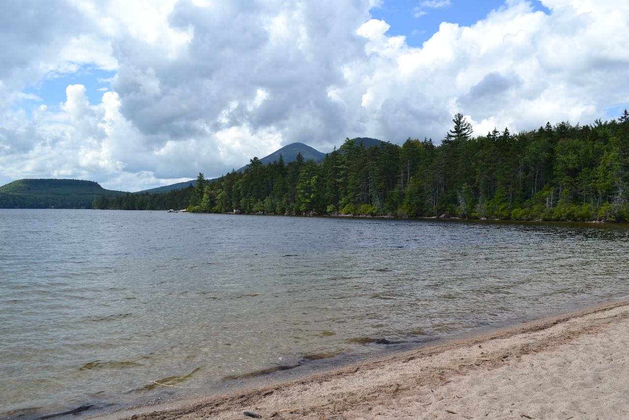
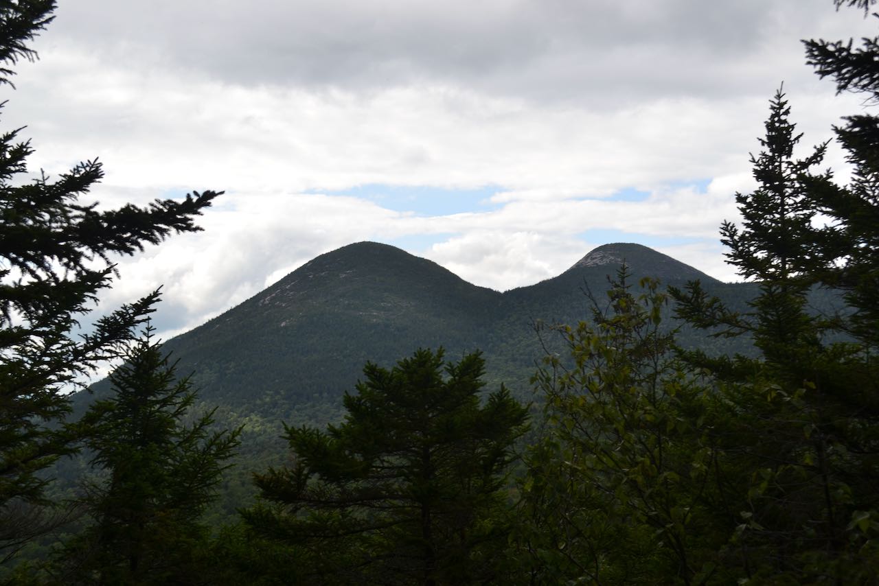
The Percy Peaks are the most recognizeable summits in the north country. With their pronounced, rocky domes, they can be spotted from a great distance. Climbing them requires great dexterity on potentially dangerous sheer rock faces. For those hikers who seek a fine north country view without the extreme element of the Percy Peaks, or for hikers looking for just an afternoon excursion, one can turn to the Percys' more diminutive southern neighbor, Victor Head. Victor Head bears the same sharp, conical shape as the Percys, but is forested over and still offers fine views. The small knob rises just to the north of Christine Lake in the town of Stark, where your hike begins. This picturesque north country waterbody is a popular summer locale for boating and fishing.
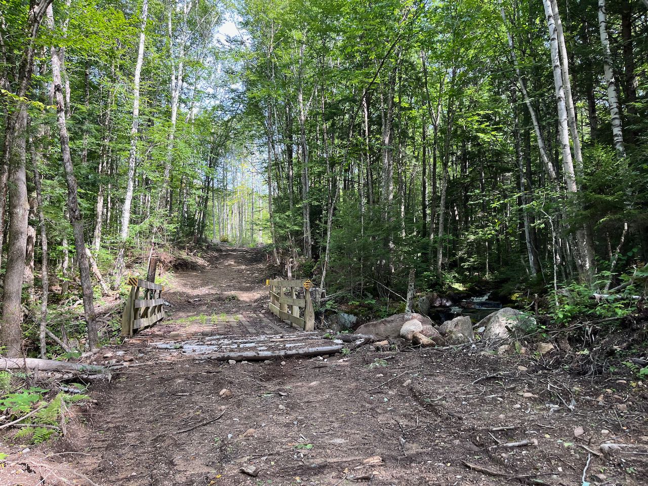
Take a moment to admire the views from the shore, which include the nearby Percy Peaks, seen just over the treeline. When you summit Victor Head, you will look back down on the lake with a grandiose birds-eye view. To begin your trip, walk back away from the lake and onto the road, and take a left past the gate onto Summer Club Road, which serves to access the cabins on the lakeshore. This is officially the start of the Old Summer Club Trail. In 0.1 miles, bear right off the road onto a newly revitalized logging road. Soon entering into the timber harvest area, after a 0.35 miles, bear left at a major fork in the logging road network, marked with signs from the Cohos Trail Association. Now on a shadier logging road, stroll across the hillside through a corridor of birches at easy grades through the property of the Forest Society's Kauffmann Forest. Most of the timbering activity is downhill from the trail at this point. Passing the historical relic of an old truck in the forest, cross Rowells Brook on a snowmobile bridge after half a mile. Not far from the bridge, the trail continues past the end of the logged area and follows the unused portion of the old woods road that was widened for the harvest. Now in a more natural environment, the old road begins to ascend for a while, flattens out on a contour, then climbs briefly again, coming to an intersection with a grassy logging road after another 0.6 miles. Proceed straight across the road onto a footpath marked with a Cohos Trail sign (Old Summer Club Trail is a segment of the 170-mile Cohos). Passing a mammoth boulder, you now follow the bed of a more ancient logging road as the trail ascends steadily but not too steeply. In 0.3 miles, take a sharp right at a sign onto Victor Head Side Trail as Old Summer Club Trail continues straight toward the Percy Peaks.
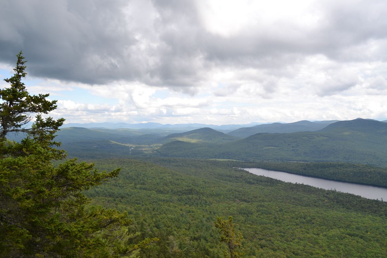
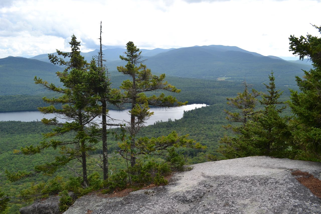
The path climbs more steeply and immediately transitions into a dark spruce forest. Your route swings around the north side of the summit as you ascend, steepening closer to the summit. The forest opens up, and the path shoots up a lush, mossy slope toward the top. After a tricky segment through a ledge band, arrive at a fork in the trail atop Victor Head. To the right is a limited window through the trees to view the nearby Percy Peaks rising above in grandeur. To the left, the path descends toward open ledges on the south slope of the peak. The view from the first ledge you come out onto is a bit restricted, but look for a less-used path on the left. This squeezes through the trees and drops down to a lower ledge where the views are much more open. From this excellent overlook, you enjoy a wide view to the mountains beyond. To the left, you look east over the valley of the Upper Ammonoosuc River toward the Mahoosuc Range. The centerpiece of the view is of course Christine Lake, and beyond, you look over Devil's Slide to the northern peaks of the Pilot Range, with Mill Mountain closer on the left, Unknown Pond Ridge behind to the right, and the main ridgeline from the Horn over Mt. Cabot to sprawling Hutchins Mountain further over.
Printable directions page